Last Updated 5/21/13
Map Project
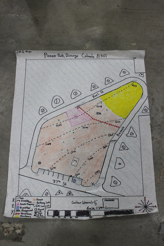
For the map project we made a topographical map of Pioneer Park here in Durango Colorado. I believe that our map is a fairly accurate representation of the park due to the accurate shape and placement of features in the park. An area of our map that may not be 100% accurate would be the large turn in the upper Northeast corner. Normally, you would measure the radius and then use a compass to draw it to scale. However, the turn is so large that we couldn’t accurately measure it and just had to estimate its length with rope. We measured the distances in the park by having the same person (Derek) walk every straight length. Then we converted twelve of his strides to feet. After that we converted feet to match our scale. A flaw with this process was that Derek had different stride lengths and walked differently whether he was traveling up or downhill. While this method did provide semi-accurate results, a better method would be to use a tape measure or place a similar object (like someone’s food) back to back and count how many times they were put together to reach the opposite end of the segment. To deal with magnetic declination, we just subtracted ten degrees from every bearing to get True North. This allowed us to draw the compass and park as if it was viewed facing True North (by using a 360 degree protractor to plot bearings on paper).